Image: NASA/GSFC/Reto Stöckli
NASA's "Blue Marble" is one of the most reproduced images in history. But "Blue Marble" is not a single photograph — it is a family of composite datasets assembled from satellite observations, and understanding what they actually represent helps you use and credit them properly.
This guide covers the main Blue Marble products, explains how they were made, and provides clear attribution guidance.
What is "Blue Marble"?
The term "Blue Marble" refers to several related products:
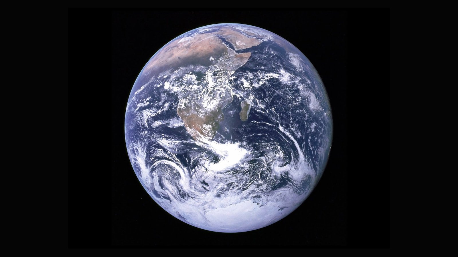
1. The original Blue Marble photograph (1972)
The iconic photograph taken by the Apollo 17 crew on 7 December 1972, showing the full Earth from approximately 45,000 km. This is a single photograph, not a composite.
Credit: NASA/Apollo 17 crew
2. Blue Marble: Next Generation (2004–2005)
A series of monthly composite images of Earth at 500 m/pixel resolution, assembled by the NASA Goddard Space Flight Center's Visualization Studio using data from the Terra satellite's MODIS instrument.
These are the textures most commonly used in 3D globe visualisations, screensavers, desktop wallpapers, and educational materials.
Credit: NASA Goddard Space Flight Center. Image by Reto Stöckli (land surface, shallow water, clouds). Enhancements by Robert Simmon (ocean colour, compositing, 3D globes, animation). Data and technical support: MODIS Land Group; MODIS Science Data Support Team; MODIS Atmosphere Group; MODIS Ocean Group; Additional data: USGS EROS Data Center (topography); USGS Terrestrial Remote Sensing Flagstaff Field Center (Antarctica); Defense Meteorological Satellite Program (city lights).
Or more concisely: NASA/GSFC/Reto Stöckli, Robert Simmon, and the MODIS team
3. Blue Marble (2012 revision)
Updated composites using data from the Suomi NPP satellite's VIIRS instrument, at higher resolution. This produced the well-known "Blue Marble 2012" image.
Credit: NASA/NOAA/GSFC/Suomi NPP/VIIRS/Norman Kuring
How the composites are made
The Blue Marble: Next Generation products are not photographs. They are composites assembled from months of satellite data:
- MODIS observations are collected daily as the Terra satellite orbits Earth
- Cloud-free pixels are selected over time (typically a month) to build a cloud-free surface map
- Atmospheric correction removes haze, aerosols, and atmospheric scattering effects
- Ocean colour data is blended to show realistic ocean appearance
- Topographic shading is added using USGS elevation data to enhance the sense of terrain
- City lights from the DMSP satellites may be overlaid for the "night side" textures
- The result is assembled into equirectangular (plate carrée) projections at resolutions up to 21,600 × 10,800 pixels (500 m/pixel)
This means the Blue Marble texture represents a statistically typical cloud-free month, not any single moment in time.
What the dataset is good for
| Use case | Suitability |
|---|---|
| 3D globe visualisation | Excellent — this is its primary design purpose |
| Educational materials | Excellent |
| Desktop wallpapers / posters | Excellent |
| Scientific analysis | Limited — the compositing, colour enhancement, and cloud removal mean this is a visualisation product, not raw data |
| Accurate surface reflectance | Not suitable — use the original MODIS data products (MOD09, MYD09) instead |
How to attribute correctly
General rule
NASA imagery is in the public domain and does not require a licence, but proper attribution is expected and professional.
Minimal acceptable credit
NASA — technically sufficient for public-domain US government imagery.
Recommended credit
NASA/GSFC or the full credit line from the specific product page (see above).
Full credit (best practice)
Use the complete credit line provided on the NASA Visible Earth page for the specific Blue Marble product you are using.
Common mistakes
- Crediting "NASA" alone when the specific product credits named individuals (Reto Stöckli, Robert Simmon)
- Using the Blue Marble texture without any credit
- Claiming the composite as a "real photograph of Earth"
- Using the image in a way that implies NASA endorsement of a product or service (not permitted)
Accessing the data
| Product | Resolution | Link |
|---|---|---|
| Blue Marble: Next Generation (monthly) | 21,600 × 10,800 px | NASA Visible Earth |
| Blue Marble 2012 (VIIRS) | Various resolutions | NASA Visible Earth |
| Blue Marble: Night Lights | Various | NASA Earth Observatory |
| Original Apollo 17 photo (AS17-148-22727) | Archival scan | NASA Image Gallery |
FP Softlab context
FP Softlab's Earth3D tool uses Earth surface data to create an interactive 3D globe visualisation. Understanding the Blue Marble dataset — its strengths, its limitations, and how to credit it — is directly relevant to anyone working with Earth visualisation tools.
The gallery includes additional space and Earth imagery, and the crediting guide covers broader image attribution practices for NASA, ESA, and partner agencies.